
Cherohala Skyway
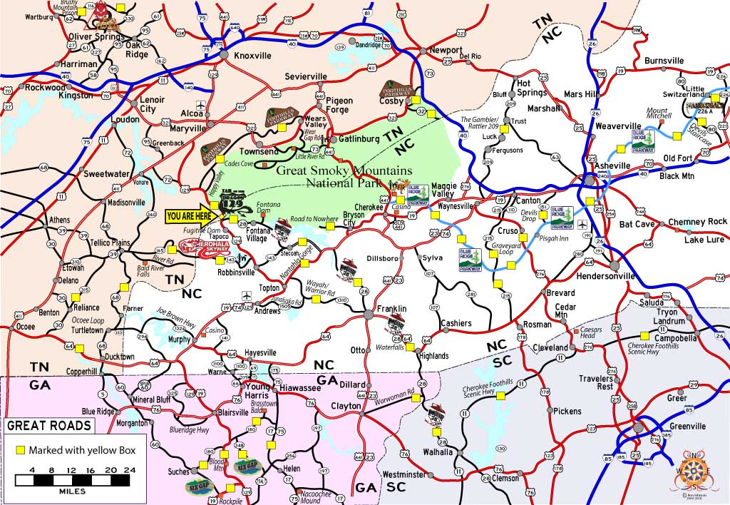
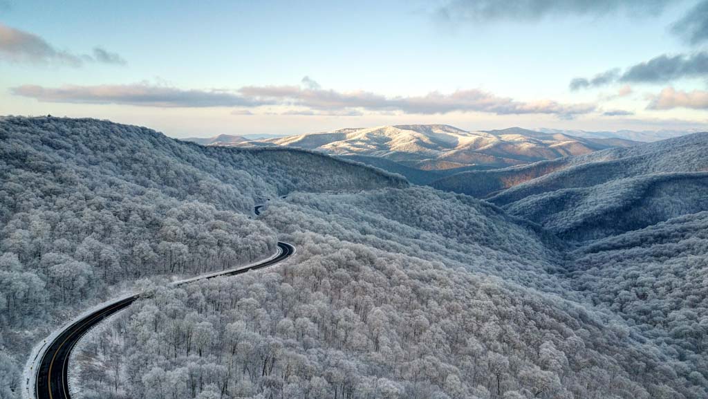
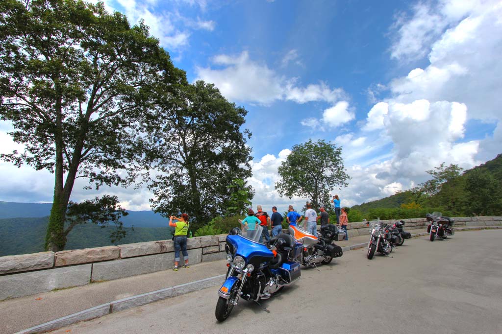
Cherohala National Scenic Byway is a 43-mile connection between Tellico Plains, Tennessee and Robbinsville, North Carolina. After 34 years, the Cherohala Skyway was completed in the fall of 1996, becoming North Carolina’s most expensive highway costing $100,000,000. It winds up over 5,400 foot mountains for 18 miles in North Carolina and descends another 23 miles into the Tennessee back country. The road crosses through the Cherokee and Nantahala National Forests thus the name “Chero…hala”. It’s well known in motorsport circles for its sweeping corners and scenic views, no surprise Cherohala Skyway was featured as one of Discovery Channel’s Top 10 Motorcycle Rides in North America.
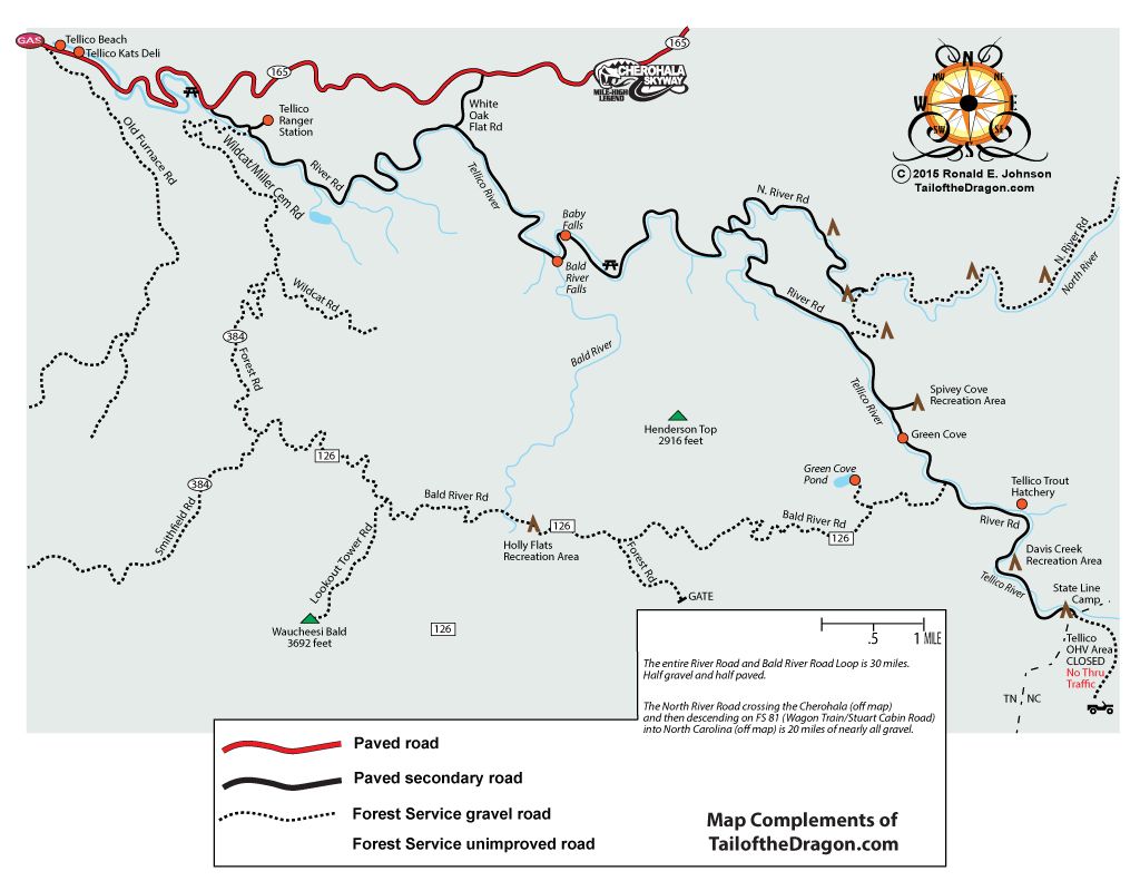
For more adventures, Cherohala Skyway has exciting gravel and dirt roads. At the North Carolina/Tennessee State Line the old wagon train road (FS 81 in NC. River Road in TN) crosses the Cherohala. This 30 mile gravel Forest Service Road offers extensive backwoods settings and rustic camping spots. Another great option for adventure is Tatham Gap, filled with history, this 8.5 mile gravel road connects Robbinsville to Andrews.
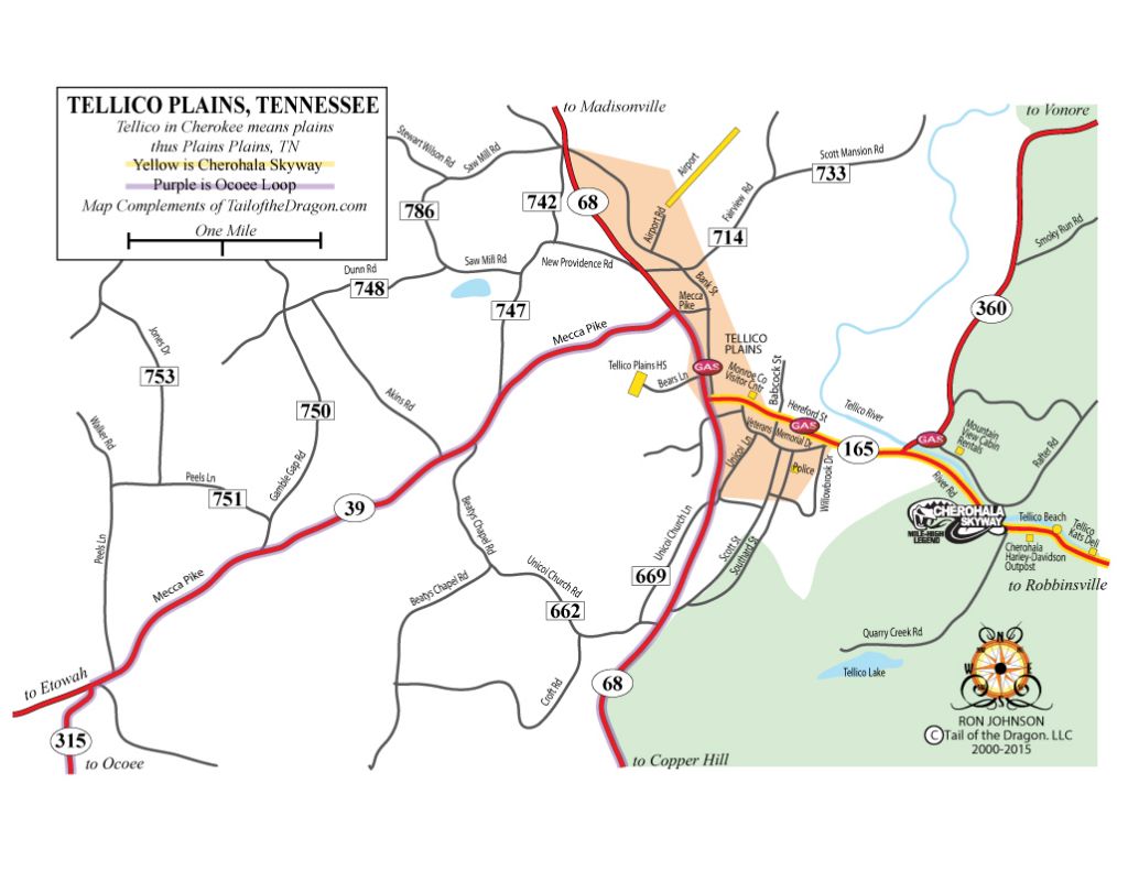
The Tellico River, at the lower elevations on the Tennessee side, is famous for its trout fishing, and when the water is high it can be quite a challenge for canoers and kayakers. The Cherohala Skyway follows the river leading you to the sleepy town of Tellico Plains where you can fill your tank and feed your belly.
More Activities Along the Route:
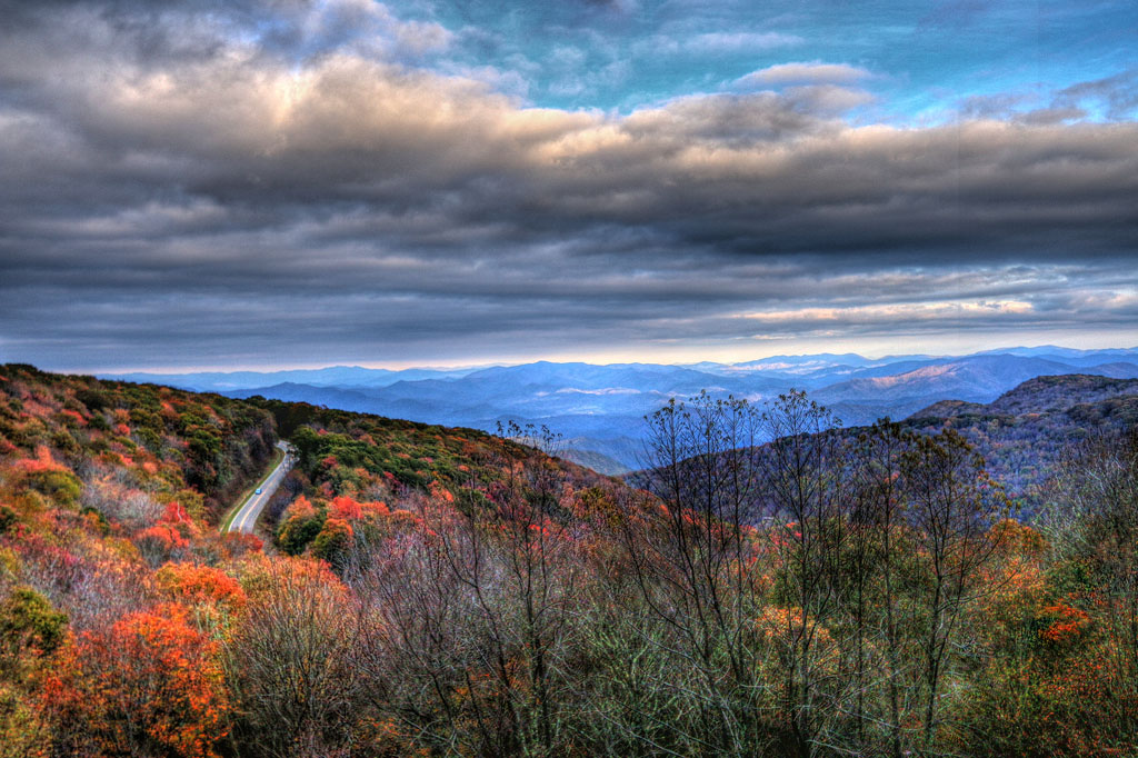
- Multiple scenic overlooks
- Bald River Falls – 100-foot waterfall
- Huckleberry Knob Trail – 1.7-mile hike with 360-degree views
- Hooper Bald – 1.3-mile hike with beautiful views and flowering shrubs. Flame azaleas are in bloom generally the first two weeks of June.
- Joyce Kilmer Memorial Forest – 2 mile trail loop home to over 100 species of trees.
Tips for the Best Travel Experience:
- The road can be desolate at night and extremely dangerous in the winter months during snow and ice events. Be mindful of the weather when traveling during the winter.
- There are no facilities for the entire 43 miles, other than a couple of seasonal restrooms, so make sure you have enough gas, snacks, and drinks to make the crossing.
- Remember to dress properly, even in the summer months it can be cold and cloudy when riding the mountain ridges.
Cherohala Skyway History
Written By Ron Johnson
Edited By Jessica Green
The dream of the Cherohala Skyway began in 1958 when Sam Williams, inspired by the TV show Wagon Train, joked at a Kiwanis Club meeting about leading a real wagon train from Tellico Plains to North Carolina. What began in jest turned into a serious movement. Six weeks after the original idea, sixty-seven covered wagons and over three hundred horseback riders gathered at the Tennessee – North Carolina State Line to make history. The event sparked momentum for a permanent highway, and by 1962, Congress funded a new route to Robbinsville through federal land. After 34 years and $100 million, the Cherohala Skyway officially opened in 1996.
HOOPER BALD AND THE BLUE BOAR
In 1908, Whiting Manufacturing Company of England purchased a large tract of land in the Snowbird Mountains of Graham County, North Carolina, now known as Hooper Bald. George Gordon Moore, an advisor for the company, was allowed to establish a game reserve on the purchased land. Around 1911, a 500-acre hog lot enclosed by split rail fencing was constructed on Hooper Bald.
In April 1912, a shipment of Russian Blue Boar arrived at the game reserve. From the beginning the hogs were able to escape the pen. By the early 1920s the population was estimated at 100 hogs, but many others had escaped confinement. A bore hunt was conducted in the pen and only two hogs were killed – the rest escaped in the frenzy.
Today the Russian Blue Boar population continues to grow despite hunting and the encroachment of civilization. A typical two-year-old male hog can weigh 180 pounds, but much larger boars have been spotted. An encounter with a wild hog is unlikely for the typical visitor, as they tend to stay in the deepest parts of the forest.
KIRKLAND BUSHWHACKERS & RENAGEDES GANGS
Written By Marshall McClung, Contributing Writer to the Graham Star
Edited By Jessica Green
The Civil War had a fascinating impact on Graham County as well as the rest of western North Carolina and nearby areas of Tennessee. North Carolina, well known for its loyalty to the homeland, comprised one fifth of the Confederate Army. But not all citizens were loyal to the Confederate Army, especially in the mountain area. Graham County, which was a part of Cherokee County until 1872, had far more trouble from bushwhackers and renegades than it did from either Union or Confederate soldiers.
One tragic event happened in the Goldmine Branch- Rock Creek area. Two young boys, John Stratton, 17, and another teenaged boy, Tom Mashburn were hiding out in the woods near the Old Tallassee Trail (also called the Belding Trail, Hudson Trail, and Dave Orr Trail). They were attempting to avoid a Confederate Conscript office that was in the area searching for young men to become soldiers. Captain Tim Lyons along with members of Company C, Third Tennessee Mounted Calvary, USA was also in the area. Lyons, a one-eyed native of Ireland, had deserted from the Union Army, and his command at this time was made up mostly of Confederate deserters, bushwhackers, robbers, old men, and young boys. The date was October 3, 1864. The group came upon Stratton and Mashburn who attempted to flee but were shot and killed on the spot.
Little information was discovered about Tom Mashburn, but a considerable amount was collected about John Stratton. Robert Stratton, the father of the young John Stratton, was also killed by bushwhackers in the same year about a month earlier. He was killed September 2, 1864, near Ball Play in Monroe County Tennessee, while hunting for cows. He was accompanied by Jack Roberts. The men saw a piece of paper lying in the road and bent over to pick it up. Turned out this was an ambush set in place by the Kirkland Bushwhackers. It was said that the main reason for the ambush was to get a new breech-loading Spencer rifle Stratton was carrying. The Kirkland gang killed Stratton and wounded Roberts, who managed to hide, but died from his wounds two days later.
It was a tough situation that our mountain residents found themselves in. The community struggled with neutrality, and gangs like Captain Lyons’s and the Kirkland Bushwhackers didn’t care which side you favored, since they favored neither side themselves, but took advantage of easy pickings. Their favorite ambush spots were said to be the Slickrock area, Big Fat Gap, Stratton Meadows, and Deals Gap at the North Carolina/Tennessee State Line.


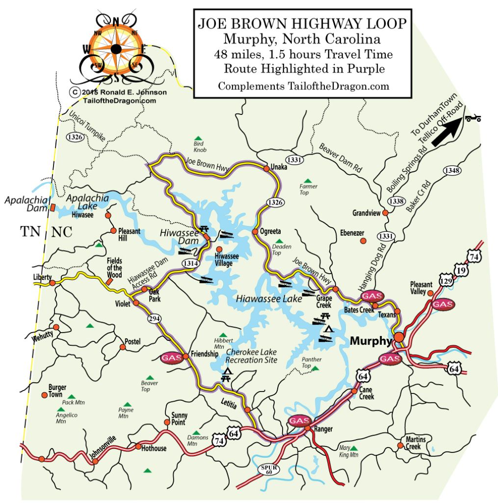
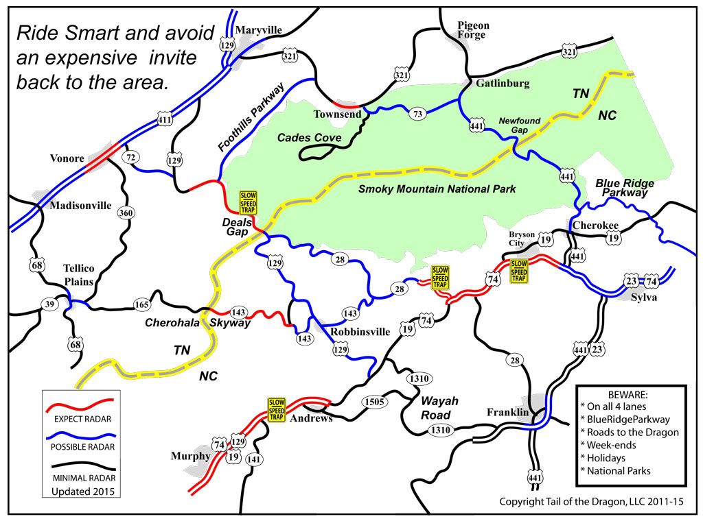
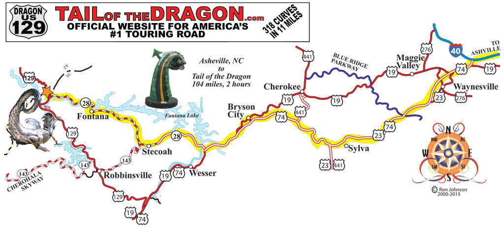
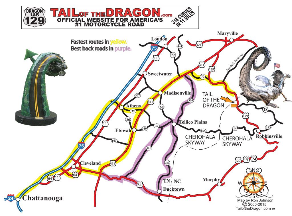
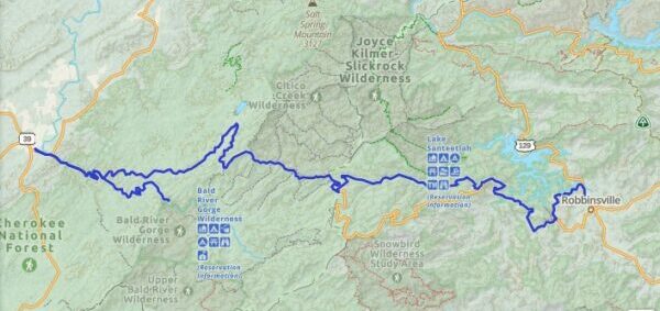
Printable Maps
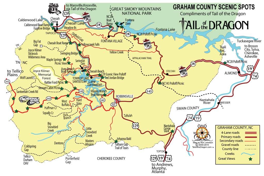
Scenic Views
Favorites Count: 2
Scenic Views near Tail of the Dragon and Cherohala Skyway
Learn More