Six Gap North Georgia
Written By Ron Johnson
Edited by Jessica Green
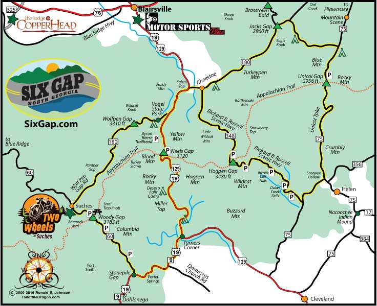
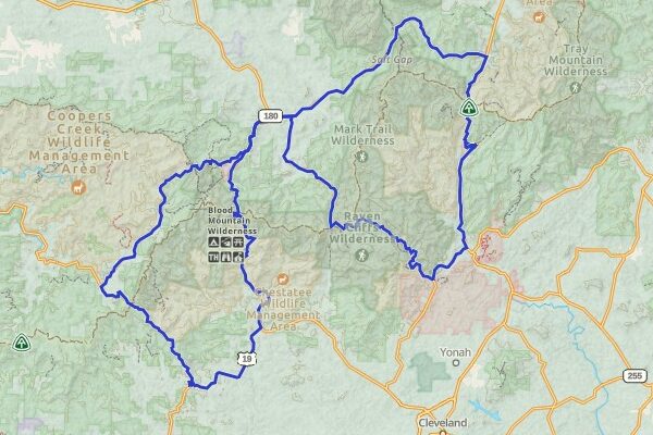
Six Gap, located in North Georgia, is a figure-eight loop approximately 77 miles long, with the southern loop measuring 35 miles and the northern loop 38 miles. Named for the six iconic mountain passes—also known as “gaps”—this route offers plenty to experience and enjoy. Four of these gaps intersect with the Appalachian Trail, emphasizing how the mountainous terrain creates exceptional riding conditions.
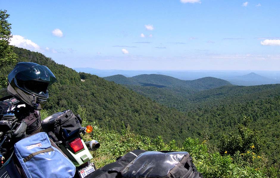
Primarily situated near the popular towns of Blairsville, Dahlonega, Helen, and Suches, this tour is sure to impress anyone adventurous enough to tackle all six mountain gaps. Dahlonega, home to numerous rider-friendly businesses, is notable as the site of the first major U.S. Gold Rush. Suches, which sits at nearly 3,000 feet elevation, is called “The Valley Above the Clouds” for its stunning scenic views. Helen is a favorite tourist spot, known for its German-themed alpine village and for hosting the longest-running Oktoberfest event in the United States. Suches is also renowned for its strong riding culture and for Wolfpen Gap Road, famous for its winding turns and continuous natural beauty.
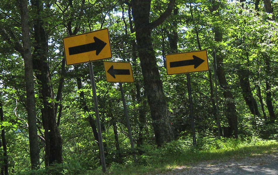
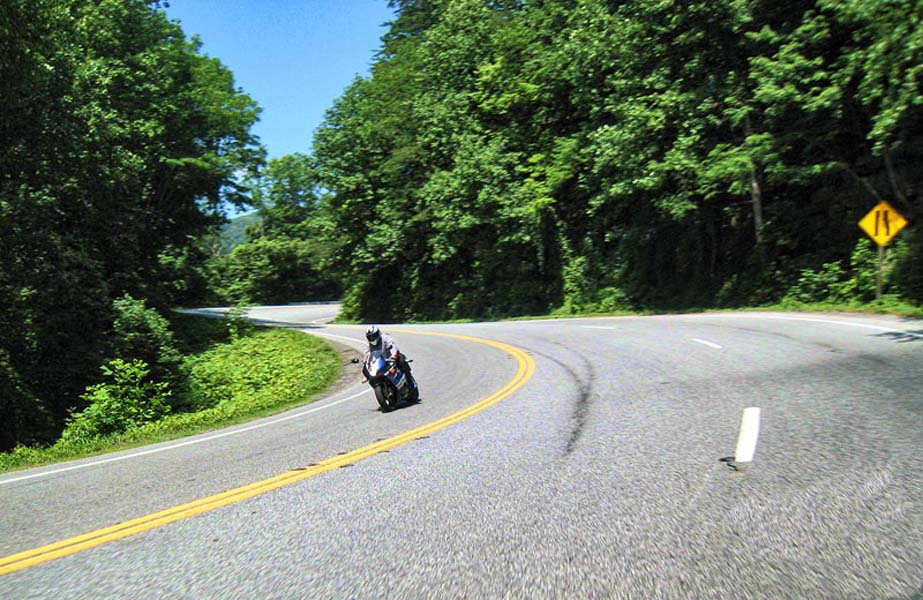
Six Gap’s figure-eight loop can be traveled in any direction, and with elevations ranging from 1,470ft to 3,480ft, adventure awaits at every turn. Starting in the town of Suches on the southwest end of the loop, the ride begins on GA-180. Wolfpen Gap Road (GA 180) is often called “Georgia’s curviest road.” Here, you’ll encounter s-curves, blind corners, and steep elevation changes. To complete the lower section of the figure-eight first, take a right onto US 129/GA 19. Heading southbound through Blood Mountain and Neels Gap toward Dahlonega and Stonepile Gap, remember to toss a rock for good luck at Stonepile Gap [see the historical section for more details]. Continue your exciting journey on GA 60 through Woody Gap and back into Suches. The 35-mile southern loop, sometimes known as the Suches Loop, will impress even advanced riders with its challenging climbs, s-curves, and never-ending turns.
The northern end of the figure-eight loop features a variety of curves and riding conditions. Starting at Choestoe on GA 180 and heading toward Jacks Gap and Brasstown Bald—the highest point in Georgia at 4,784ft—you’ll find plenty of adventure. Continuing south on Unicoi Turnpike (GA 75), the twisties range from wide sweepers to some tight, short-radius corners. While there are no true switchbacks, a few turns come close. You’ll wind your way into Helen, where you can stop for German-style food and drinks or cool off in the Chattahoochee River. Leaving Helen and heading north on the Richard Russell Scenic Byway (GA-348), you’ll encounter some of the steepest climbs on the Six Gap route, with an average grade of 7% for over seven miles, and the steepest reaching 15%. At the end of the 40-mile byway, you’ll return to Choestoe, having completed all six mountain gaps and the exhilarating 77-mile adventure.
More Activities Along the Route:
• Brasstown Bald: Highest point in Georgia at 4784 feet. On a clear day from the lookout tower you can see the skyscrapers of downtown Atlanta 80 miles away
• Stonepile Gap: Gravesite of Native American Cherokee Princess Trahlyta. Marked by a 6+ foot stone pile where travelers toss a stone for luck
• Chattahoochee River in Helen, GA: Popular tubing destination with Bavaria-themed village, food and activities
Tips for the Best Travel Experience:
• The loop can be completed in one day –- we recommend staying one night in a nearby town to experience the best of North Georgia’s Blue Ridge Mountains.
• Brasstown Bald and Helen, GA are both a few miles off the technical loop, but they are worth exploring.
• Gas stations are few and far between on mountain roads, so fill up when you can!
HISTORY
Written By Ron Johnson
Edited By Jessica Green
Six Gap, carved in the mountains of North Georgia, boasts a rich and varied history stretching back to the early 1500s. This scenic region has witnessed dramatic events, from fierce conflicts among Native American tribes to the historic gold rush. Today, Six Gap is celebrated by travelers and driving enthusiasts alike for its breathtaking scenery, challenging routes, and the wealth of history woven into its landscape.
Early Inhabitants
The earliest civilization in the North Georgia area was the Moundbuilders, dating back to around 950 AD. As their population declined during the 1300s, the Cherokee tribes began to grow in number. By 1700, the Cherokee population was estimated to be between 30,000 and 50,000 members. However, as settlers moved into the territory, the native population suffered greatly. By 1830, when the Trail of Tears began relocating the Cherokee to Oklahoma, their population had decreased to an estimated 20,000.
Today, visitors can explore Native American history along the route at sites such as Nacoochee Mound, Brasstown Bald, and Stonepile Gap. The Nacoochee Mound, dating to the early 1500s, is a large Indian mound located a few miles east of Helen at the GA 75/GA 17 intersection. Brasstown Bald, the highest point in Georgia at 4,784 feet, is said in Cherokee tradition to have served as a refuge for survivors after a great flood. According to legend, Princess Trahlyta of the Cherokee lies at rest at Stonepile Gap. She was known for drinking from a nearby “fountain of youth,” known as Porter Springs, to maintain her famed beauty. A warrior named Wahsega, who courted her but was rejected, grew angry and kidnapped her, imprisoning her in an unknown location. Her dying wish was to be buried in the mountain forests of her birth. A historical marker at Stonepile Gap, her supposed resting place, reads, “Custom arose among the Indians and later the Whites to drop stones, one for each passerby, on her grave for good fortune.” Today, the pile of stones at the site stands about six feet high.
Blood Mountain
Blood Mountain, with an elevation of 4,458 feet, is the highest peak on the Georgia section of the Appalachian Trail. The origin of its name is surrounded by several stories. One legend claims that a long and bloody battle between the Cherokee and Creek Indians caused the mountain to turn red with blood. Since there were numerous conflicts between the two tribes, it is difficult to determine which specific event led to the naming of Blood Mountain.
Unicoi Turnpike
The Unicoi Turnpike, originally known as the Cherokee Trading Path and commonly referred to as “the old trading path,” was built by James Wyly and completed in 1819. Many sections of the path have since been lost. The Unicoi Turnpike served as the primary route for settlers and traders traveling into what is now eastern Tennessee. Starting from present-day Knoxville, it ran south through Vonore and Tellico Plains, crossed into North Carolina, passed through Murphy, followed the Hiawassee River to Unicoi Gap in northern Georgia, continued along Spoilcane Creek (GA 75), and passed through Helen to Nacoochee.
Gold
The mountains of North Georgia have been known for many centuries as “gold country.” Before the California Gold Rush, between 1830 and 1849, the area was flooded with miners hoping to strike it rich. Gold claims in the region date back to Hernando de Soto’s expeditions in the 1500s, during which he learned from Native Americans how to melt down gold (Wiggins, 2018). However, many consider the area’s first truly recorded evidence of gold mining to be in 1829, near Dahlonega, Georgia. Over the following decade, tensions grew between immigrant miners and local Cherokee tribes (Wiggins, 2018). This tension lead to one of the saddest chapters in early American history—the “Trail of Tears” relocation of the Cherokee to Oklahoma during the 1830s.
From 1838 to 1861, the U.S. government operated a mint in Dahlonega, Georgia. The center of activity was Auraria, located south of Dahlonega. Once a bustling business town with five hotels, twenty saloons, and a newspaper, Auraria is now a crossroads ghost town, with only its history remaining. During this period, many local miners relocated to California to take part in the famed California Gold Rush of 1849 (Wiggins, 2018).
Wiggins, K. (2018, January 21). Striking it rich: American gold rushes of the early 19th century. Smithsonian National Museum of American History. https://americanhistory.si.edu/explore/stories/striking-it-rich-american-gold-rushes-early-19th-century
Government Preservation
In the early 1900s, the federal government began acquiring lands across northern Georgia. In 1936, the Chattahoochee-Oconee National Forest was officially established, encompassing 867,000 acres across 26 counties and featuring a wealth of natural resources.
The Appalachian Trail, managed by the National Park Service, stretches approximately 2,185 miles from Springer Mountain in Georgia to Mount Katahdin in Maine. Constructed in segments, its first section opened in 1923, and the entire trail was completed in 1937.
At Neels Gap (formerly Frogtown Gap), near Blood Mountain, the Appalachian Trail crosses US 129 and passes directly through a breezeway of a log cabin store. This is the only location where the Appalachian Trail passes through a man-made structure.
Six Gap – North Georgia
If you are seeking unforgettable curvy mountain roads and numerous historical sites, Six Gap is a route that belongs on your bucket list. Along the ride, you can explore significant historical sites and moments, ensuring everyone an unbeatable mountain adventure.


Printable Maps
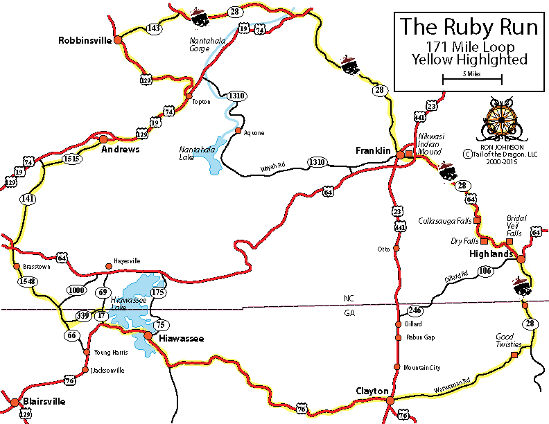
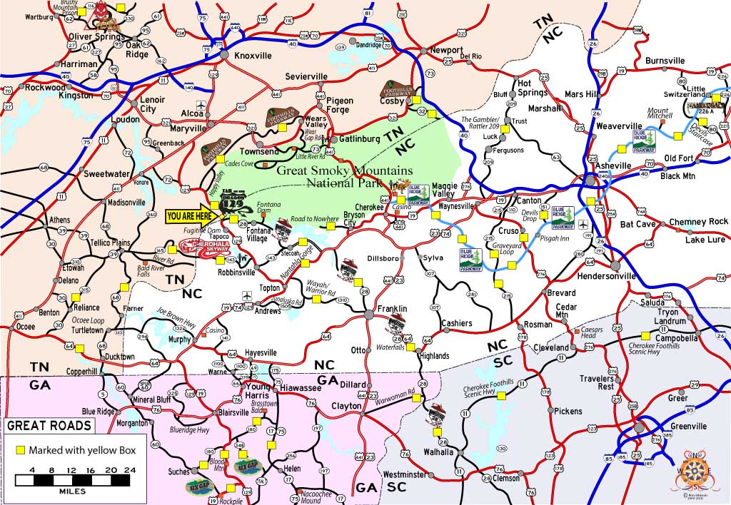
North Georgia Ruby Run
Favorites Count: 0
174 Mile Loop which includes Moonshiner28, Warwomen Road, and small towns of north Georgia and western North Carolina.
Learn More