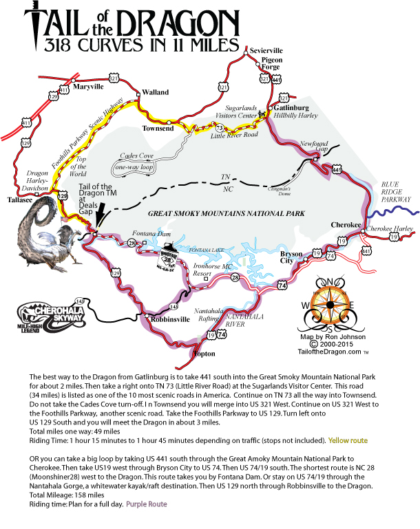

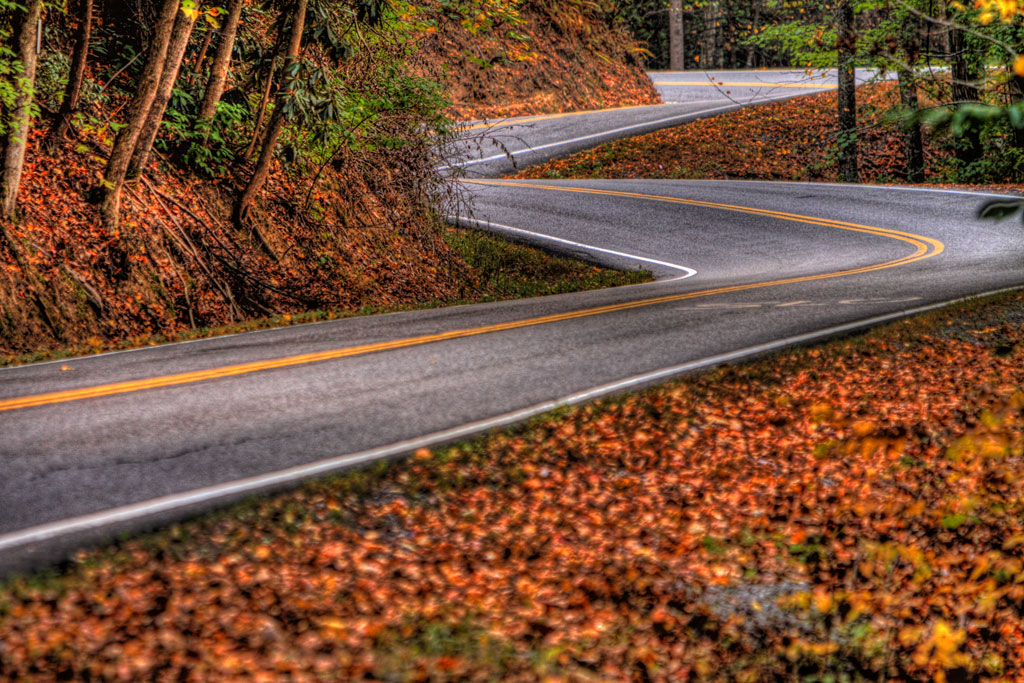


Tail of the Dragon
Written by: Jessica Green
Before the 1700s, the path was originally worn down by wild buffalo, Native Americans, and later, European settlers. Only two towns have ever existed in this challenging terrain: a Cades Cove Settlement in the early 1800s and the Town of Calderwood in 1913. It wasn’t until the 1930s that this famed mountain route was paved for the first time. For decades, the newly paved US 129 remained lightly traveled, used mostly by locals, hunters, and the occasional lost tourist. The only business for miles was a small motel and diner at Deals Gap, where US 129 meets NC 28. This motel and diner changed ownership multiple times from the 1950s to the 1990s, known over the years as the Moodys’, the Craftons’, Mac’s Motel, and later, the Crossroads of Time. Today, it is Deals Gap Motorcycle Resort.
By the 1990s, people were discovering and falling in love with the winding, less crowded roads around the Tail of the Dragon. To help spread the word about these thrilling curves, Doug Snavely—a well-known Road Atlanta motorcyclist—and the Crossroads of Time launched “Deals Gap Hot Lap,” a newsletter that connected and updated riders nationwide.
By 1999, local motor enthusiasts Ron and Nancy Johnson noticed the 11-mile stretch was being driven more frequently. Wanting to give visitors a way to remember the experience, they founded the Tail of the Dragon business and set up shop at The Overlook, near mile marker 9. In 2000, the Tail of the Dragon website launched and has grown rapidly ever since. Today, Tail of the Dragon T-Shirt Shack is located at the intersection of US 129 and NC 28 in North Carolina.
Also active in the early 2000s was Killboy, a local rider who believed the spirit of nature and motorsports could be captured in a single image. He set up along the route, photographing every traveler and sharing the images on his website. Today, Killboy photographers are stationed along the road to capture your experience and adrenaline.
Tail of the Dragon has a rich history packed into its 11 miles, and with a growing following, there’s only more to add to the story. Over the years, it has become what many call their “happy place,” drawing individuals eager to experience its thrill and adrenaline firsthand. We’re excited to see events and rallies increase in number each year, knowing that just one trip will leave people hooked.

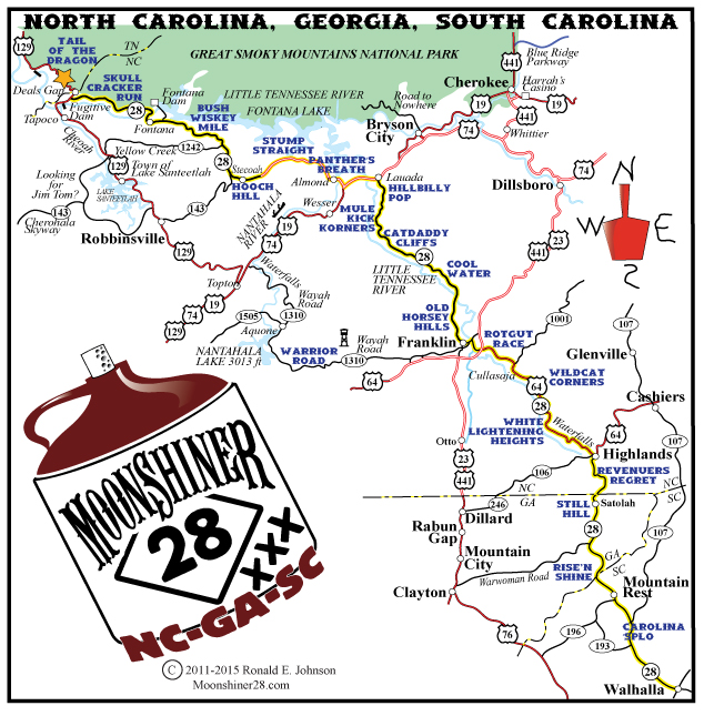
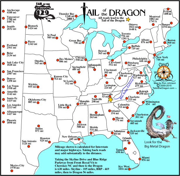
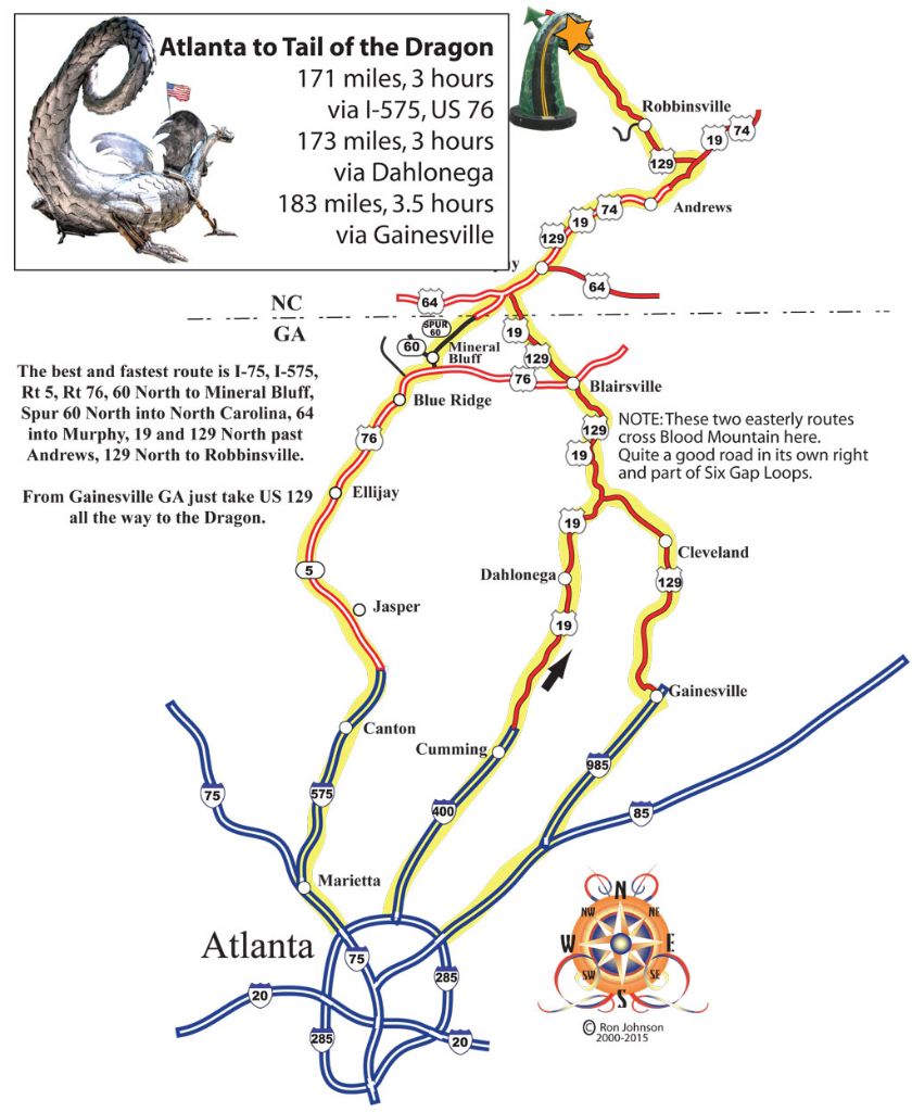
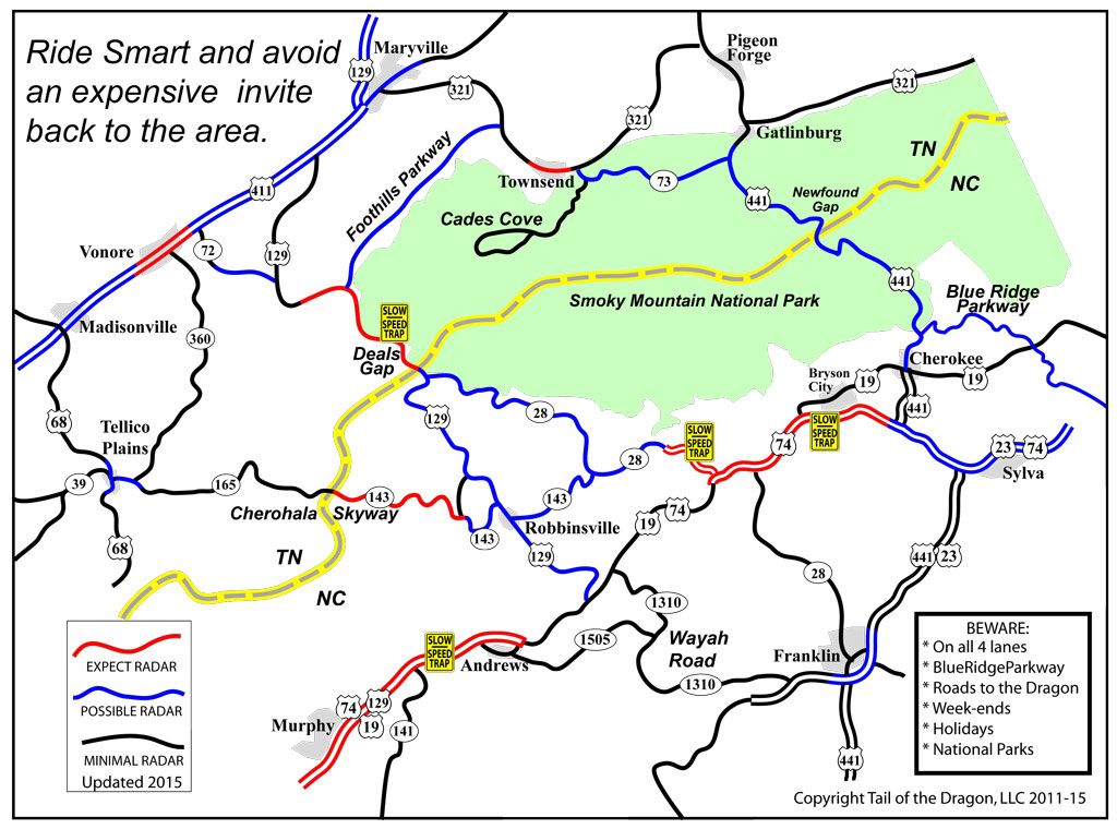
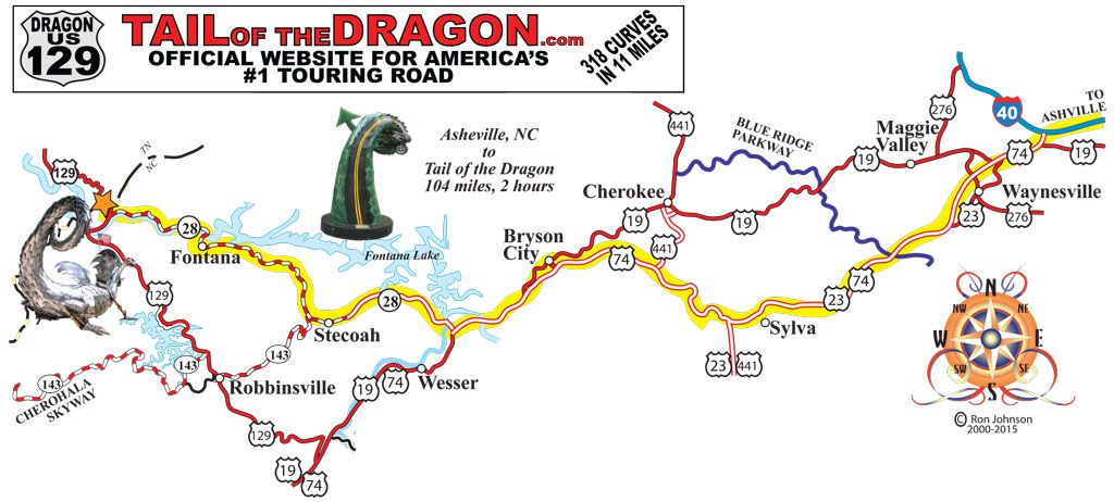
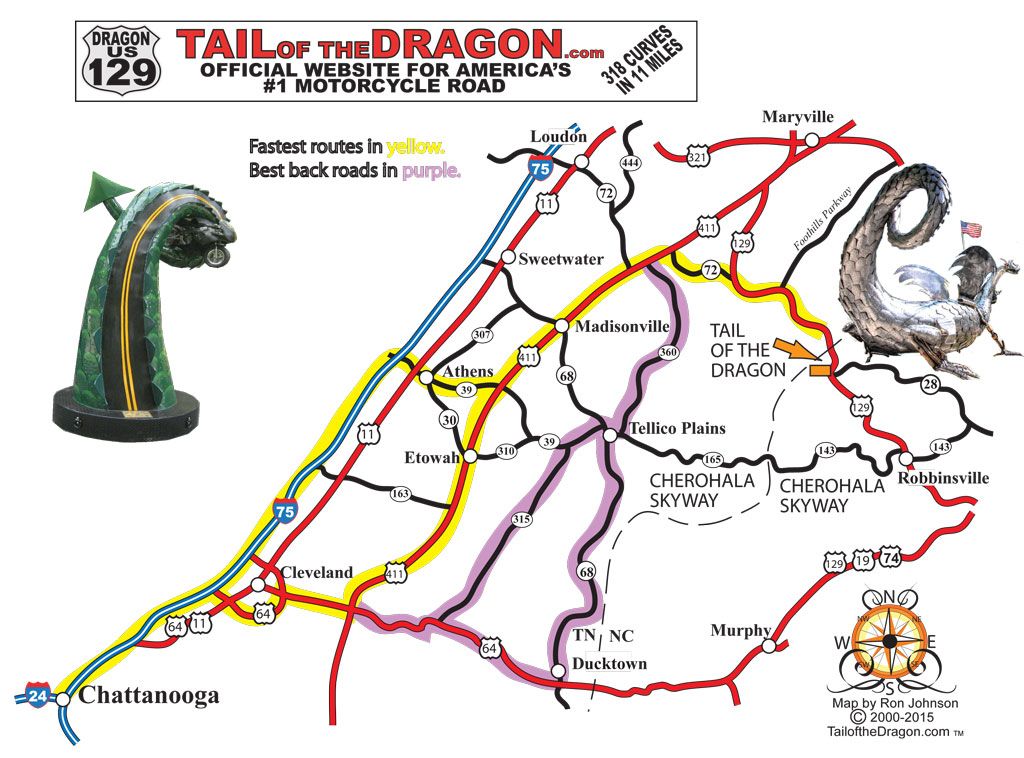
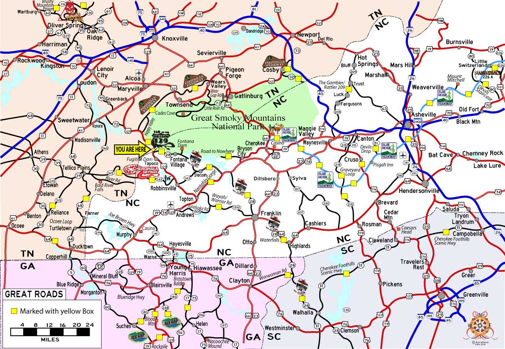
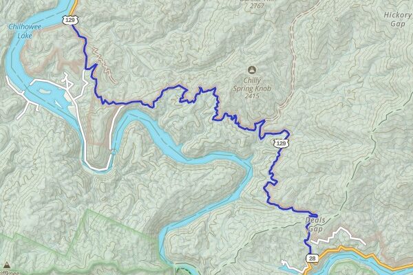
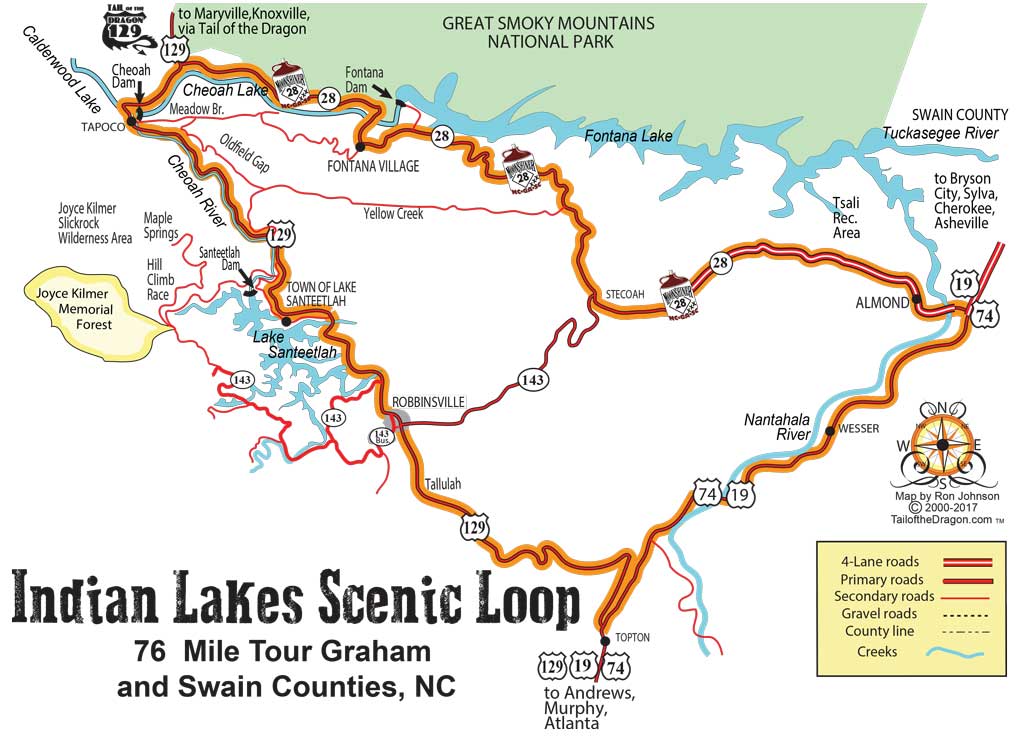
Printable Maps
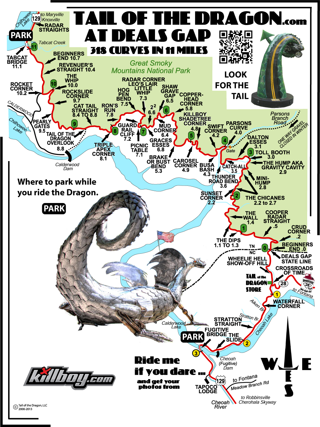
Tail of the Dragon Parking
Favorites Count: 0
Parking locations for both north and south ends of the Tail of the Dragon.
Learn More