Tail of the Dragon History
Written by Ronald E. Johnson
Edited by Jessica Green
Tail of the Dragon is considered by many as one of the world’s best motorcycling and sports car roads. Originally, the route was an animal track worn down by large herds of buffalo and then used by the Cherokee Native Americans for centuries. In the early 1700s, the first settlers to use the trail were hunters and trappers. In 1756, British soldiers struggled through the mountain gaps to establish Fort Loudon, one of the first outposts west of the Appalachian Mountains. The fort was attacked by Native Americans in 1760, forcing the few surviving soldiers to retreat.
A crude roadway was built in the early 1800s, used to access the extremely remote settlement of Cades Cove via the Parsons Branch Road. There were many conflicts between the Cherokee and European settlers who infringed upon their world. This undeclared warfare resulted in one of the saddest events in our early American history – the Trail of Tears relocation of the Cherokee to Oklahoma during the 1830s. Many Native Americans refused to assemble and leave the only land they had ever known. The Tail of the Dragon area was one of the remote paths Cherokee people used to evade the Army sent to capture them.
The Civil War brought more bloodshed to the Dragon and surrounding areas. Giving testimony to the times, today you can visit Bas Shaw’s gravesite located at mile 6.5 on the Tail of the Dragon. Shaw was buried after being killed by Confederates as he was being transported to prison in Asheville. The area had far more trouble from bushwhackers and renegades than it did from either Union or Confederate soldiers. Gangs, such as the Kirkland Bushwhackers, often attacked Northern patrols and anyone else who happened their way. The forested mountains offered the perfect hiding place to escape detection.
By the end of the 1800s, additional settlers moved into the area, and landowners began collecting tolls for use of the road. Toll Booth Corner, located at mile 3.0, was a place to pay for the right to cross private property.
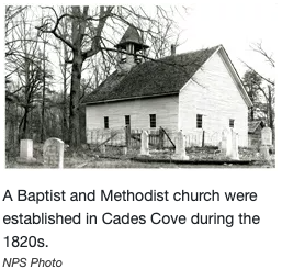
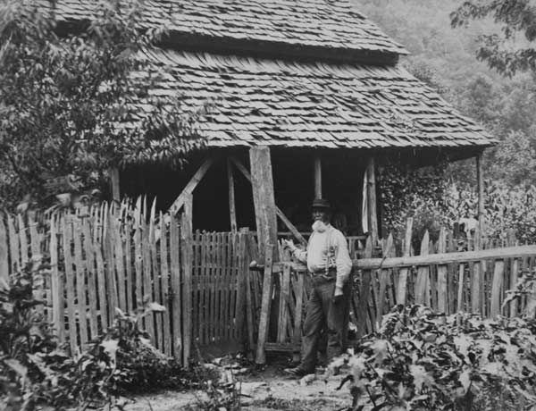
Church in Cades Cove Settlement circa 1820s
Toll Booth circa 1890s
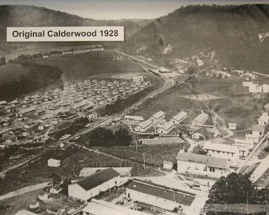
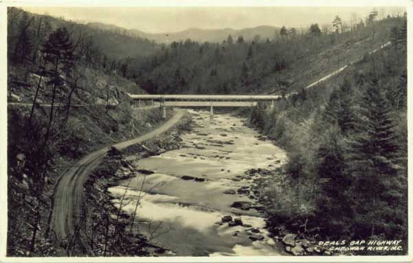
Circa 1913, a town was born on the Tail of the Dragon. Calderwood, formerly the Howard farm property, was established as living quarters for employees constructing Cheoah Dam in 1917 and later Calderwood Dam in 1930. A railway ran from Knoxville, through Calderwood, and followed the Little Tennessee River to Tapoco in North Carolina. Equipment, supplies, and workers were transported on this line. Calderwood was also used by Alcoa Aluminum, aka Tapoco, Inc., as a corporate retreat for their executives.
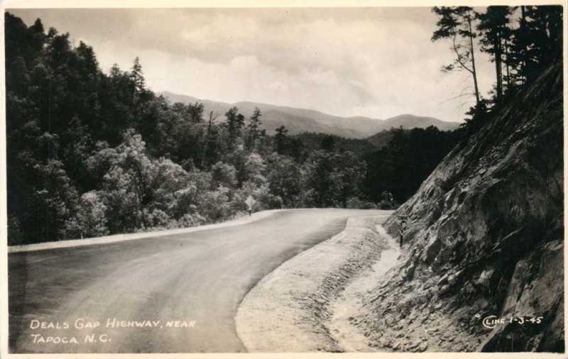
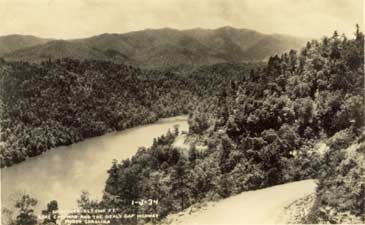
Tail of the Dragon in the late 1920s was designated as TN72 on the Tennessee side and NC288 on the North Carolina side (today’s NC28 to Fontana). Completion of the bridge near Tapoco in 1931 allowed connection of NC108 to NC288. In 1934, NC 108 and TN72 was renumbered as US129 and was most likely paved for the first time around that date.
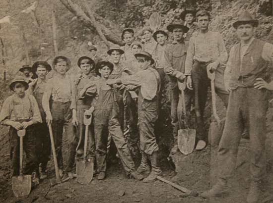
Road Crew
Local road crew circa 1900s
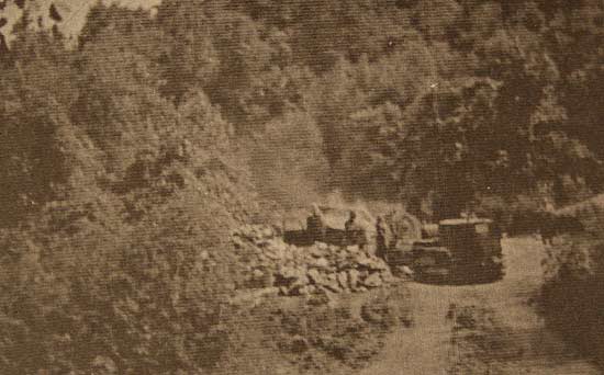
Roadwork circa 1920s
Roadwork on 228 (now NC 28) circa 1920s
1930s Post Card
Early 1930s post card taken shortly after first paving.
US129 circa 1930
US129 circa 1930
View from US129 1/2 mile south of Tail of the Dragon T-Shirt Shack. The road appears to not be paved.
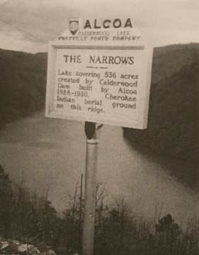
Narrows
The Narrows circa 1950s - today the Tail of the Dragon Overlook. The rock wall remains to this day.
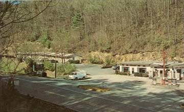
The new US 129 was only lightly traveled for decades, primarily by locals, hunters and lost tourists. The only business for miles was a small motel and diner located at Deals Gap – the junction of US129 and NC28. The motel and dinner went through many different owners from the 50s to the 90s. It was owned by the Moodys, the Craftons and was known after that as Mac’s Motel and later The Crossroads of Time. Today it is Deals Gap Motorcycle Resort.
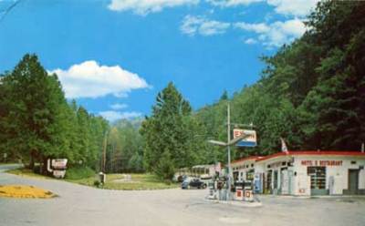
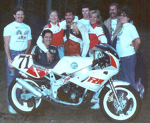
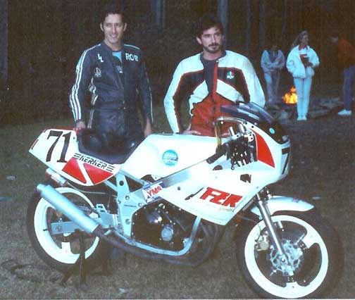
In 1992 Doug Snavely, a popular Road Atlanta motorcyclist, hearing about a great ride in the Smokies, came up to test US129 for himself. The ride proved even more exciting than he had ever imagined. He met Pete, owner of the Crossroads of Time, a small café/motel located at the junction of US129 and NC28. At the time Pete catered to fishermen, hunters, and the few lost vacationers. Doug sold Pete on promoting the road to motorcyclists and got a job as manager at the Crossroads.
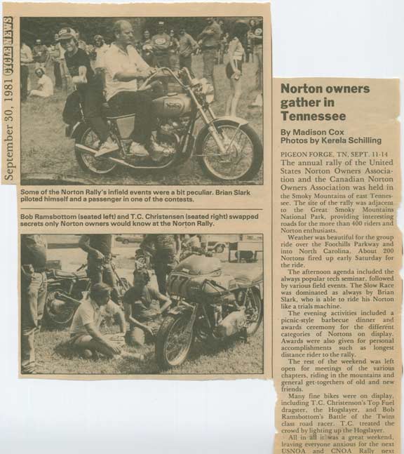
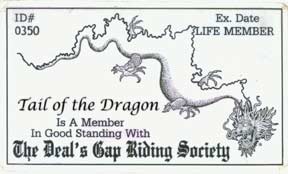
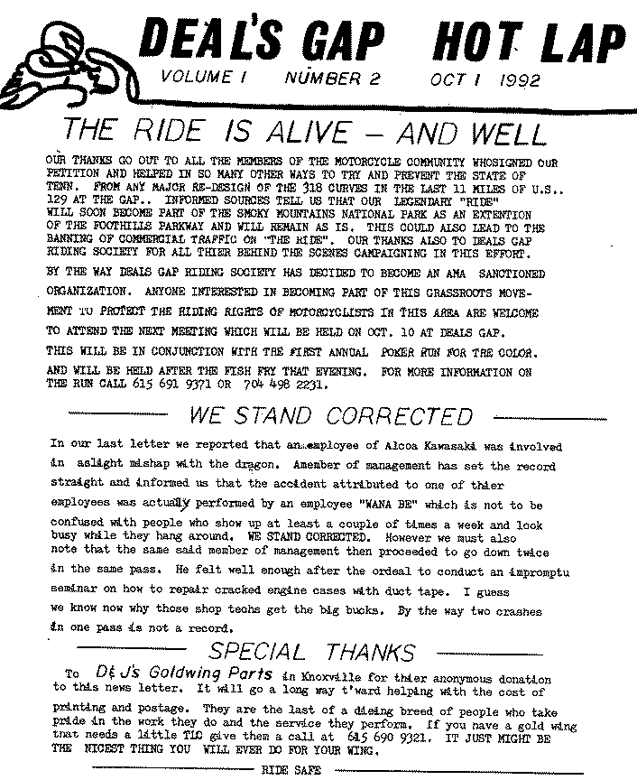
Snavely began to publish the monthly Deals Gap Hot Lap newsletter on September 1, 1992. He also got the road mentioned in Rider Magazine. Snavely created the Deals Gap Riding Society, with some 350 members from all over the United States. In the next few years, motorcycle riding increased dramatically at the Tail of the Dragon, and has continually done so each year.
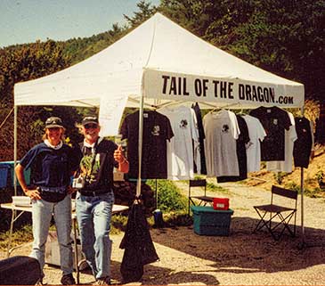
Tail of the Dragon gained additional notoriety after the website www.TailoftheDragon.com went online in 2000. This site, run by Ron and Nancy Johnson of Robbinsville, offers T-shirts, souvenirs, photos, maps, and advice on how to survive at the Dragon. Over the next decade, alongside the advancement of the internet and technology, communication has traveled globally of the exciting 11-mile stretch named Tail of the Dragon.
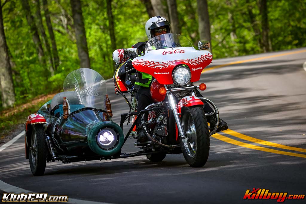
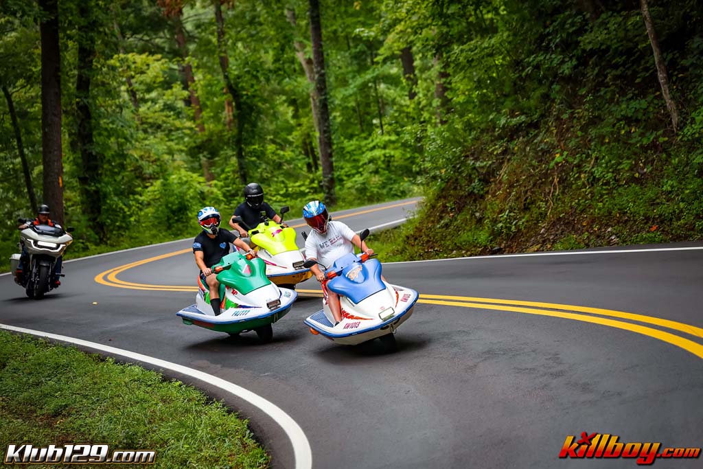
Also active in the early 2000s was Killboy, a local rider who believed the spirit of nature and motorsports could be captured in a single image. He set up along the route, photographing every traveler and sharing the images on his website. Today, Killboy photographers are stationed along the road to capture your experience and adrenaline.

Tail of the Dragon may have a checkered history, but today it is becoming “the destination” for hundreds of thousands of riders, drivers, and even bicyclists looking to tame the beast.